Is there a finer way to spend a mini-break in the UK than with a few miles of stomping around the countryside, stopping off at traditional pubs here and there, and sampling local ale and cuisine? We think you’d be hard pushed to find a better use of your time (though we are biased…and from Devon). This weeks blog focuses on 3 of the numerous routes that you can enjoy walk from, which take in one of two of our fantastic local watering holes…
Please ensure you check, check and triple check your own route before heading out; the maps and descriptions below are only for ideas and should not be considered as detailed planned routes!
It would also be sensible to check what time the sun sets, and how long your walk will take, as being stuck out on the moors in the dark is no one’s idea of a good time. Unless you’re an owl. Some of the more remote pubs have limited opening hours so do check with them direct if they are open if you’re relying on them for something to eat.
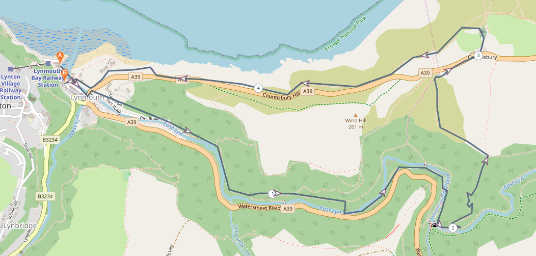
1. Lynmouth to Lynmouth, via Rockford, Brendon & Countisbury (circular, 9.5 miles, difficult)
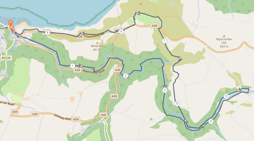
Challenging Pub Walk Across Exmoor; Image from plotaroute.com
This route takes in your choice of up to seven pubs across Lynmouth, Rockford, Brendon and Countisbury. To fit this all in before dark, you’ll need to start fairly early in Lynmouth. Head up to Watersmeet from there along Tors Road and the well marked footpaths from there. The views up the river are stunning, particularly at this time of year while Autumn has full hold. At Watersmeet House, you’re keeping left and following the river, crossing over a footbridge at the roughly 2.5 mile mark. The footpath takes you away from the river slightly and you’ll come uphill, meeting a single track road. Turning left here, you drop down into Rockford, and the welcome sight of The Rockford Inn at the 3.5 mile mark. With a roaring fire and a great selection of local ales, it’s the perfect spot to stop by the river and have a breather.
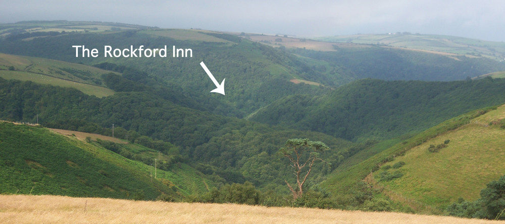 Rockford Inn (photo from their website)
Once you’re ready, head out of the door and turn right, keeping the river on your left and following the road (keep an ear our for cars) until you reach Brendon; in Brendon, about a mile from The Rockford Inn is The Stag Hunters. Again, another roaring fire and selection of fantastic local ales awaits you – and this is a great point to stop for lunch.
Once you’re ready to head off (and bear in mind that this is around the half way point…and the next section is uphill!) take a right, and keep to the road. Turn left at the ‘complicated’ juncation in Brendon, and walk over a beautiful little stone bridge, following the road around to the left so you’re effectively doubling back on yourself. Come off the road on a footpath on the left along the river, and stick to it – you’ll end up going past another bridge to the Rockford Inn again.
Just after this, bear right taking the path that skirts around Wilsham, where you’re able to see some beautiful ancient Devon hedges. You’ll drop down along this path and walk over a couple of small streams, before beginning the ascent up to the A39. This gives you fantastic views back down the valley, but is a bit of a slog! When you reach the road, cross straight over into a gravel car park called Barna Barrow, and bear left along the paths after this; you’ll come round the back of the stunning Countisbury Church. Walk through the church yard, and then you’ll be able to see The Blue Ball Inn and, you’ve guessed it…another warm fire and excellent array of ales.
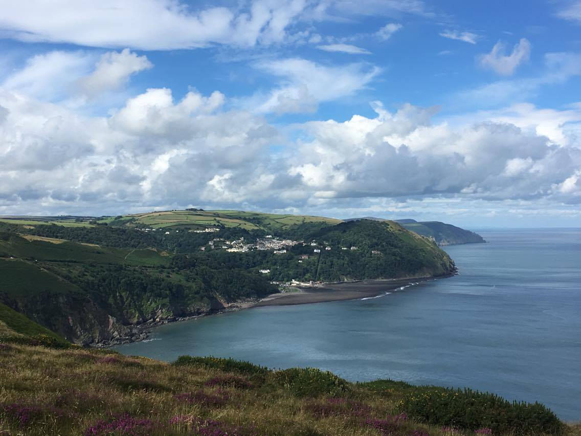
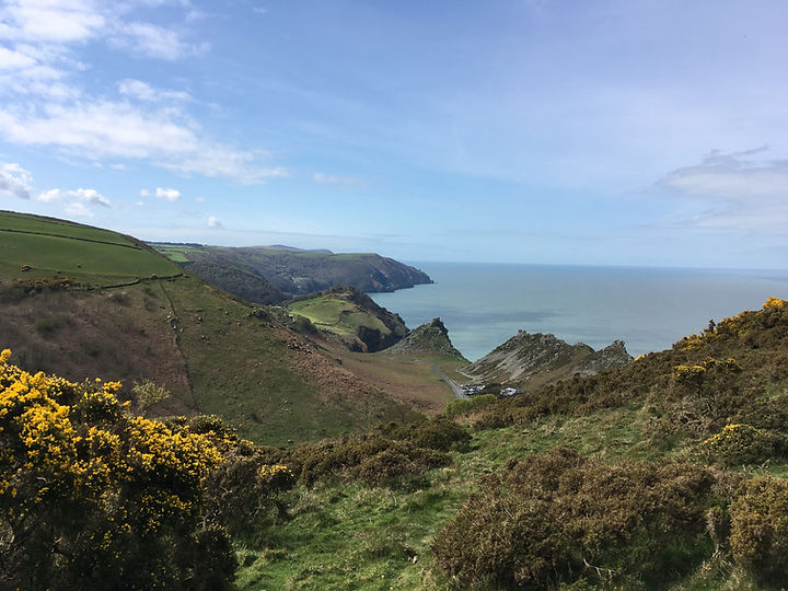
View from Countisbury back towards Lynton and Lynmouth
Rest a while here, but don’t leave it too long as you’ve got to get back down the South West Coast Path to Lynmouth and the terrain is steep. There are a couple of options at this point; you can go back the way you came through the pub car park, back through the church yard, and then turn left and stay on that path all the way down to Lynmouth, or you can come out of The Blue Ball, turn left and walk down to a small pond through a couple of gates off the road. You will need to cross the main road to join the South West Coast Path at some point, but you can either do this at the gate of an old sheep track just at the top of the hill (which is the way that we have marked it on the map) though do bear in mind that the section of path after this to join you to the coast path is exceptionally steep. Alternatively, go over Wind Hill, and cross the road further down. Both routes give spectacular views of the Bristol Channel, and of Lynton, Lynmouth and the surrounding valleys. If, after nearly 8 miles, that really is enough, ask while you’re at The Blue Ball Inn to call one of the two local taxi firms to take you down the hill.
Back down in Lynmouth, there are four pubs. The Rising Sun and it’s sister pub The Rock House (which closes over some of winter so do check that it’s open), The Village Inn on Lynmouth Street and our very own The Ancient Mariner. We never close (!) and yes, there is a gorgeous fire and lots of local tipple to choose from. We also serve food 6pm-8pm or 9pm depending on the day, so why not finish off with a well earned delicious meal and a couple of drinks? And the dog is welcome too!
2. Lynmouth to Lynmouth via The Blue Ball (circular, 4.7 miles, difficult)
Lynmouth to Blue Ball Inn pub walk; image from plotaroute.com
A shorter version of the previous walk, this option cuts out Brendon and Rockford. With the same start as the previous walk, you meander your way up to Watersmeet from Lynmouth. When you reach Watersmeet House (which is open at the weekends over winter) you once again keep to the left, with both rivers on your right. When you begin climbing, take the first steep path on your left to bring you up onto Countisbury.
There is a small level section at the top of this where you have three options to get to the Blue Ball. You can turn right and add a bit more distance to your walk; this route brings you out again at the A39 and the gravel carpark called Barna Barrow detailed above. Or, you can go straight ahead, which takes you though fields. This does result in walking on the main A39 for a short stretch. This is a narrow, windy road and is not something that we would recommend for larger groups. The most scenic route is to take the path left (as indicated on our map above), along Winston’s Path which hugs the side of the hill and provides stunning views down the valley back towards Watersmeet and the East Lyn river.
You’ll come to a small pond, called Dew Pond. Stay with the pond on your left and up a small hill, through a couple of gates, is the Blue Ball Inn. Once again, your return from here down to Lynmouth provides you with a couple of options, but we’d recommend crossing over the road into the pub car park, and heading up to the stunning Countisbury Church. The path takes you through the churchyard, and then turning left you join the South West Coast Path all the way down the hill to lovely Lynmouth where the local public houses mentioned above, and other eateries, will welcome you with open arms.
3. Lynmouth to Lynmouth via Lynton and Valley of Rocks (circular, 4.1 miles, difficult to moderate depending on route chosen and use of Cliff Railway)
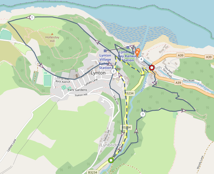
This route is quite flexible, and can be made more or less difficult depending on what you’re looking for. For starters, if you’re starting off in Lynmouth, you could get the Cliff Railway up to Lynton if it’s open (this closes over winter months so do check it’s operational before planning your route). This cuts out the very steep zigzag path at the beginning and makes the route relatively moderate in terms of hills. This does change the route slightly from the map above, and to join back to the path, you’d need to turn right when you’re out of the railway, and take the road down towards North Walk, turning left down the hill, in front of St Mary’s Church.
Following along North Walk is a really spectacular footpath – with reasonably sheer drops down to the water below. Keep your eyes peeled for the resident local goat colony gripping to the cliff faces and marvel at their agility. On the main North Walk path, there is a steep left hand turn (there is only one) that takes you on a shorter route into the Valley of Rocks. Staying on the main path will still take you into the Valley of Rocks, but a bit further down and with less of a sudden climb back up.
Assuming you’re taking the shortcut, the path opens out into the dramatic Valley of Rocks, which has provided the back drop for numerous TV series, films and photography. The current series of Britannia has been filmed here, along with Top Gear, a feature film called Winter Ridge and many others.
The view is otherworldly and you can really get a sense of the feeling of wonder that this area must have struck into the romantic authors Shelley and Coleridge.
Stick to the path that you’re on, and cross over the road and cattle grid so that you’re on the pavement, and start walking back through Lynton main town. Just outside the Valley of Rocks is The Sandrock pub, on the right hand side. This cosy spot is great for a little refreshment. Heading out of here, turn left again and carry on walking down through the village.
This will take you past the local cinema, the town hall, shops, cafes, hotels and churches. It’s a great way to get a feel for the village. You’ll come to St Mary’s Church, which will be in front of you, and just down from this keeping the church on your left are a set of steps past the technicolour cafe, Charlie Friday’s. This leads you to The Queens pub where additional refreshment would be a very sensible plan. Coming out of here and turning right, you are presented with The Crown Hotel – call in here for a cosy drink and to have a look at the fantastic murals by famous local artist, the late Mick Cawston.
From here, you can choose to head over to The Cottage Inn, which is the home of Fat Belly Brewery (a brewery that we stock at The Ancient Mariner) and holds a huge range of exciting craft beers. This is the point at which the energetic bods can take the scenic route back home to Lynmouth up Summerhouse Hill, as indicated on the map in dark blue, or head back into Lynton via the yellow and blue route to take you back down to Lynmouth without the uphill climb. Summerhouse Hill is a steep ascent and descent but at the peak it provides a stunning vista of the Bristol Channel over to Wales, Hollerday Hill and Lynton.
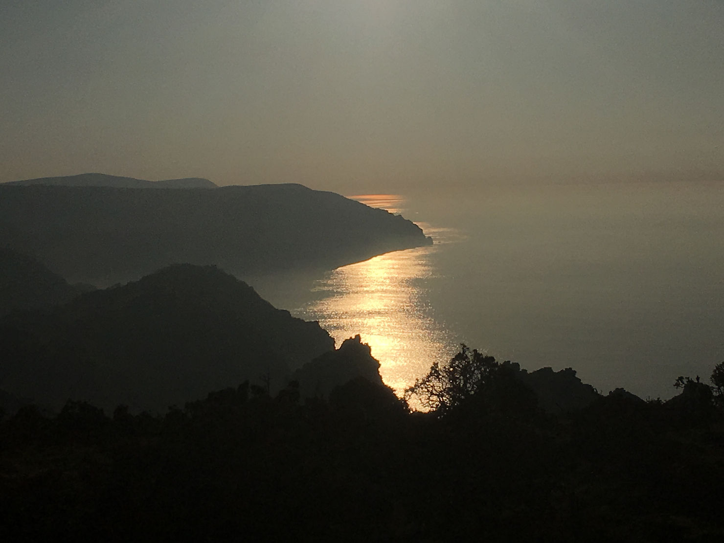 Sunset over Valley of Rocks
Those are just three of the many, many routes available in Lynton and Lynmouth that allow you to experience local scenery, pubs and the area. Book to stay at The Bath Hotel on a 2 night stay for a walking break with a big discount available, to make the most of one or two of these routes. Maps are available from reception for those intrepid explorers who are heading out!